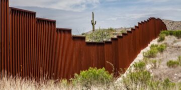
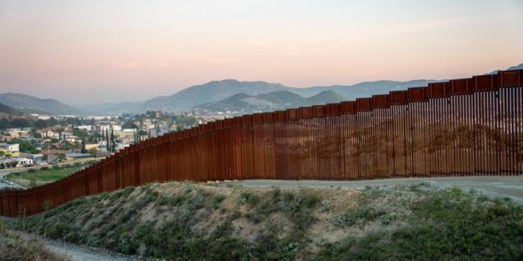
International boundaries represent the geographic demarcations of political or legal jurisdictions, delineating areas of sovereignty among countries, customs territories, and sovereign states. The establishment of these borders is known as boundary delimitation. While certain borders, like those within free movement zones such as the European Union, may have minimal or no physical barriers, others, such as the India-Pakistan or North Korea-South Korea borders, are heavily guarded with restricted access points.
International boundary lines are the official divisions between countries, marking where one nation’s territory ends and another’s begins. They play a crucial role in defining sovereignty, legal jurisdictions, and political relations between nations. These boundaries vary in their nature, from heavily guarded borders to open crossings, and can be demarcated by physical features like rivers or mountains, or by man-made markers such as fences or walls. International boundary lines are essential for maintaining peace, security, and cooperation among nations on a global scale.
1. Radcliffe Line
Radcliffe Line was the boundary line between the Indian and Pakistani portions of the Punjab and Bengal provinces during British India, established on August 17, 1947. It was named after its architect, Sir Cyril Radcliffe. It extends from Gujarat to the border of Jammu and Kashmir. In this region, the Line of Control (LOC) is under military control and was renamed after the Simla Agreement of July 3, 1972. Today this Boundary Line, rather border, is divided into two parts – the West and the East part. The West Radcliffe Line serves as the Indo-Pakistan Border and the East Line serves as the Indo-Bangladesh Border. However, there were certain disputes against this Border. It included the Chittagong Hill Tracts and Gurdaspur District. Radcliffe negotiated and came to the conclusion that since there the canals that irrigated the Amritsar District lay in Gurdaspur, Gurdaspur had to be kept under one administration. Also because it had the maximum number of religious shrines for Sikhs. (India).
2. Durand Line
Delimited by Sir Mortimer Durand with the agreement of the erstwhile Amir of Afghanistan in 1893. This line is the international border between Afghanistan and Pakistan in South Asia. It was originally established as the international border between British India and Afghanistan to fix the limit of their respective spheres of influence and improve diplomatic relations and trade. A well-known controversy is that although Pakistan widely recognizes its western border, it is highly unacknowledged by Afghanistan. This has resulted in controversies and conflicts.
3. Hindenburg Line
It was between France and Germany; the line was improvised by the German Army on the Western Front in World War I. It was the strongest and the last of the German Army’s defense which consisted of three well-defended trench systems established in 1917, throughout 1918. However, from the other side, the Australians along with the British meticulously planned an attack on this line against Germany to bring down its power, then.
- The Siegfried Line (between France and Germany) was built as an extension of the Hindenburg defensive line on the western front of World War I by the Weimar Republic and later the Third Reich of Germany in the 1930s.
- The Maginot Line was established by France as a defensive line towards Germany before World War II. The Maginot line was rendered obsolete following the successful invasion of France by Germany following the outbreak of World War II.
4. Mannerheim Line
It was a defensive fortification built against the Soviet Union by Finland. After the October Revolutions, the Finns declared independence in 1917. However even though the Russians recognized Finland’s independence, it wanted to assure the new state by drawing a line of the border against their not-so-sincere neighbors.
5. McMohan Line
The McMahon Line is the boundary line between Tibet and the North-east region of India proposed by British colonial administrator Sir Henry McMahon at the 1914 Simla Convention signed between British and Tibetan representatives. It is the legal boundary between China and India. It stretches from the eastern border of Bhutan to the Himalayan crest, following the bend in the Brahmaputra River. Historically, it delineated the frontier between Tibet and Assam during British India. The McMahon Line is regarded by India as the legal national border, but China rejects the Simla Accord and the McMahon Line, contending that Tibet was not a sovereign state and therefore did not have the power to conclude treaties.
6. Line of Actual Control (LAC)
The Line of Actual Control serves as the demarcation between India and China, separating India-controlled territory from China-controlled territory in the former princely state of Jammu and Kashmir. It closely approximates most of the “McMahon Line” in the eastern part of its border with India. Following China’s 1962 attack and subsequent ceasefire, the LAC was established in 1963, though it’s not internationally recognized as a formal boundary.
7. Blue Line
A border demarcation between Lebanon and Israel published by the United Nations on 7 June 2000 for the purposes of determining whether Israel had fully withdrawn from Lebanon.
8. Oder-Neisse Line
This line is the boundary (border) between Germany and Poland. The border is named after the two rivers, Oder and Lusatian Neisse rivers, that run along the line of the border – Oder and Neisse Border. The border recognizes the Polish-German border according to the Potsdam conference. It was acknowledged and recognized by unified Germany in 1990.
9. 17th Parallel
The 17th latitude from the equator divided erstwhile North and South Vietnam. It was demarcated based on the 1954 Geneva Accords. The 17th parallel became irrelevant after the unification of Vietnam in 1976.
10. 20th Parallel
It is located at the 20th northern latitude which is used as the border between Sudan and Libya.
11. 22nd Parallel
The 22nd latitude north of the equator marks a major portion of the Sudan-Egypt border.
12. 25th Parallel
The northernmost section of the Mali-Mauritania border is marked using this line.
13. 31st Parallel
The 31st northern latitude marks the border between Iraq and Iran.
14. 38th Parallel
After World War II, when Japan lost the war, it also lost the territory of Korea in 1945. The United States marched in and entered the South and the Soviet Union took over the North by mutual agreement, thereby dividing the country by the 38th Parallel at the central part of the Demilitarized zone . It is the now known border between North and South Korea.
15. 49th Parallel
It is located 49 degrees north of the equator. Demarcated after the Anglo-American Convention of 1818 and the Oregon Treaty of 1846, it forms the international border between the northern USA (excluding Alaska) and Canada.
16. Inter-Entity Boundary Line
This line of boundary divides Bosnia and Herzegovina into Republika Srpska and the Federation of Bosnia and Herzegovina.
17. Green Line / Attila Line / UN Buffer Zone
A demilitarized zone, patrolled by the United Nations Peacekeeping Force in Cyprus (UNFICYP), that was established in 1964 and extended in 1974 after the ceasefire of 16 August 1974.
Conclusion
The world’s international boundary lines are more than mere demarcations on a map; they are powerful symbols of sovereignty, identity, and geopolitical dynamics. These borders have shaped the course of history, influenced cultural and economic exchanges, and continue to play a crucial role in global stability and conflict resolution. Understanding the significance of these boundaries, from the heavily fortified to the relatively open, is essential for appreciating the complexities of international relations and the ongoing efforts to manage and, in some cases, transcend these divides in pursuit of a more peaceful and interconnected world.


